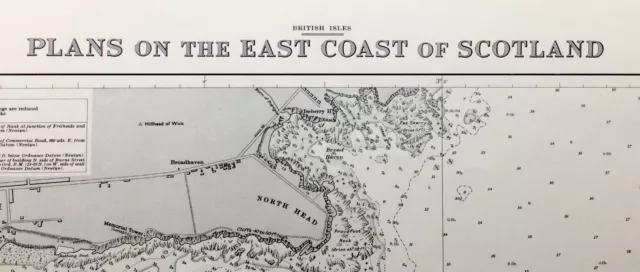
Admiralty Sea Chart. No.1462. PLANS ON THE EAST COAST OF SCOTLAND. 1961.
Vintage Admiralty Sea Chart.
Chart No. 1462.
BRITISH ISLES.
PLANS ON THE EAST COAST OF SCOTLAND. with insert charts of -
WICK AND APPROACHES.
HELMSDALE HARBOUR.
NAIRN HARBOUR.
BURGHEAD.
HOPEMAN.
PORTKNOCKIE.
LOSSIEMOUTH.
BUCKIE.
BANFF and MACDUFF.
FRASERBURGH.
APPROACHES to FRASERBURGH.
Scales from 1:3,000 to 18,000.
Soundings in Fathoms.
1961 edition.
Originally published at the Admiralty, 29th September, 1961.
This edition 1961.
Printed corrections to 1968.
Lighthouses, beacons, markers, Etc., may be marked by a red dot or circle.
This chart is in very good, unmarked, condition.
This chart is flat, has been folded once at source, and is a standard size of 41 x 28”, approx., vertically presented.
Shipping, in a postal tube, to U.K. by Evri. ( New name for Hermes ).
Shipping overseas by eBay's Global Shipping Program
- Antique: Yes
- Date Range: 1960-1969
- Type: Nautical Map
- Format: Sheet Map
- Year: 1961
- Cartographer/Publisher: British Admiralty
- Original/Reproduction: Vintage Original
- City: Wick, Fraserburgh, Lossiemouth, Nairn, Helmsdale, Banff, Macduff
- Country/Region: Scotland
- County: Caithness, Moray/Elginshire, Banffshire, Aberdeenshire
PicClick Insights - Admiralty Sea Chart. No.1462. PLANS ON THE EAST COAST OF SCOTLAND. 1961. PicClick Exclusive
- Popularity - 2 watchers, 0.0 new watchers per day, 450 days for sale on eBay. Good amount watching. 1 sold, 0 available.
- Best Price -
- Seller - 3,402+ items sold. 0.5% negative feedback. Great seller with very good positive feedback and over 50 ratings.
People Also Loved PicClick Exclusive
 2 watchers
Admiralty Small Craft Leisure Charts 5613 | Irish Sea, East Part & Isle of Man
£86.25 Buy It Now 3 watchers
Falkland Islands. Bay Of Harbours. 1880. Admiralty Sea Chart. N0.1935.
£25.00 Buy It Now or Best Offer 4 watchers
ADMIRALTY SEA CHART. No. 1827. HARBOURS on the SOUTH-EAST COAST of ENGLAND. 1987
£14.99 Buy It Now 5 watchers
ADMIRALTY SEA CHART. PLANS on The EAST COAST of IRELAND. No. 633....1977
£11.00 Buy It Now or Best Offer 3 watchers
ADMIRALTY SEA CHART. GREAT YARMOUTH. No.1534. ENGLAND EAST COAST. 2008
£15.00 Buy It Now or Best Offer


