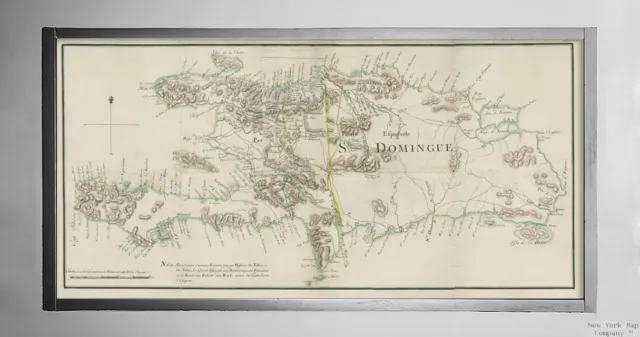
1772 Map of Haiti | Dominican Republic | Hispaniola | Island of St. Domingue | V
£32.76 Buy It Now or Best Offer, £5.77 Shipping, 14-Day Returns, eBay Money Back Guarantee
Seller: historic_photos_maps ✉️ (1,251) 97.5%,
Location: Toledo, Oregon, US,
Ships to: WORLDWIDE & many other countries,
Item: 204690868692
1772 Map of Haiti | Dominican Republic | Hispaniola | Island of St. Domingue | V.
Map size: 12 inches x 24 inches (60.96cm x 30.48cm) | Ready to frame in standard size frame (12x24) | Frame not included | Archival quality reproduction
1772 Map Haiti | Dominican Republic | Hispaniola I. de St. Domingue. Shows proposed boundary changes on Hispaniola between the French and Spanish colonies of Saint-Domingue (officially the Republic of Haiti since 1804) and Santo Domingo (officially the Dominican Republic since 1844). Showing alternate boundary in the north central part of the island and note at bottom referring to treaty negotiators and Governors Valliere and De Solano.
Powered by SixBit's eCommerce Solution
- Original/Reprint: Reprint
- Framing: Unframed
- Color: Black & White
- Photographer: Unknown
- Unit of Sale: Single Piece
- Original/Licensed Reprint: Licensed Reprint
- Format: Wall print
- Number of Photographs: 1
- Size: 24 inch
- Features: Matte
- Country/Region of Manufacture: United States
- Material: Paper
- Finish: Matte
- Theme: History
- Type: Map
- Featured Person/Artist: Unknown
- Year of Production: 1800-1950
- Image Color: Color
- Subject: History
- Production Technique: Giclee
- Time Period Manufactured: 1800-1950
- Style: Documentary
PicClick Insights - 1772 Map of Haiti | Dominican Republic | Hispaniola | Island of St. Domingue | V PicClick Exclusive
- Popularity - 0 watchers, 0.0 new watchers per day, 36 days for sale on eBay. 0 sold, 1 available.
- Best Price -
- Seller - 1,251+ items sold. 2.5% negative feedback. Good seller with good positive feedback and good amount of ratings.
People Also Loved PicClick Exclusive

1772 Map of Haiti | Dominican Republic | Hispaniola | Island of St. Domingue | V
£32.76 Buy It Now 25d 20h
2004 Map of Dominican Republic | Vintage Dominican Republic Map Reproduction | V
£32.76 Buy It Now 25d 20h
1858 Map of Hispaniola | Greater Antilles | Dominican Republic | Haiti | Island
£32.76 Buy It Now 26d 6h
1826 Map of Dominican Republic | Haiti | Hispaniola | Vintage Dominican Republic
£33.72 Buy It Now 26d 7h
1858 Map of Hispaniola | Greater Antilles | Dominican Republic | Haiti | Island
£32.76 Buy It Now 26d 5h
Poster, Many Sizes; Map Of Hispaniola Haiti Dominican Republic 1762
£154.32 Buy It Now
Poster, Many Sizes; Map Of Haiti & Dominican Republic 2010
£154.32 Buy It Now
1906 Map of Hispaniola Haiti Dominican Republic Caribbean Decor Poster Print
£77.11 Buy It Now 2 watchers
Haiti Dominican Republic - Lucas 1823 - 23.00 x 37.68
£91.51 Buy It Now 1 watcher
West Indies. Haiti/Dominican Republic borders differ. BARTHOLOMEW 1886 old map
£16.00 Buy It Now


